ZIP Code 5: 38587 - WALLING, TN
ZIP Code 38587 is the postal code in WALLING, TN. Besides the basic information, it also lists the full ZIP code and the address of ZIP code 38587. Whatsmore, there is more information related to ZIP Code 38587. For example, nearby ZIP code around ZIP Code 38587, etc.
ZIP 38587 Basic Information

The basic information of ZIP Code 38587 is as follows, including: country, county, city, FIPS and etc.
| State | County | City | ZIP Code 5 |
|---|---|---|---|
| TN - Tennessee | White County | WALLING | 38587 |
What is the plus 4 zip code for 38587 ZIP Code? Below is the detail.
38587 ZIP+4 Code List

What are the 4 digit zip extensions of ZIP Code 38587? ZIP code 38587 has many plus 4 codes, and each plus 4 code corresponds to one or more addresses. Below we list all the ZIP+4 codes and their addresses in the ZIP Code 38587. You can find a 9-digit ZIP Code by a full address.
| ZIP Code 5 Plus 4 | Address |
|---|---|
| 38587-5002 | 200 (From 200 To 298 Even) JOPPA RD, WALLING, TN |
| 38587-5004 | 100 (From 100 To 699) GRAHAM RD, WALLING, TN |
| 38587-5009 | 1500 (From 1500 To 1598 Even) HICKORY NUT MOUNTAIN RD, WALLING, TN |
| 38587-5010 | 1301 (From 1301 To 1399 Odd) HICKORY NUT MOUNTAIN RD, WALLING, TN |
| 38587-5011 | 1700 (From 1700 To 1798 Even) HICKORY NUT MOUNTAIN RD, WALLING, TN |
| 38587-5013 | 2100 (From 2100 To 2198 Even) HICKORY NUT MOUNTAIN RD, WALLING, TN |
| 38587-5015 | 2900 (From 2900 To 2998 Even) HICKORY NUT MOUNTAIN RD, WALLING, TN |
| 38587-5017 | 100 (From 100 To 498 Even) POWERHOUSE RD, WALLING, TN |
| 38587-5018 | 101 (From 101 To 499 Odd) POWERHOUSE RD, WALLING, TN |
| 38587-5019 | 500 (From 500 To 834 Even) POWERHOUSE RD, WALLING, TN |
Post Office in ZIP Code 38587

WALLING is the only post office in ZIP Code 38587. You can find the address, phone number, and interactive map below. Click to view the service and service hours about WALLING.
-
WALLING Post Office

Address 11839 MCMINNVILLE HWY, WALLING, TN, 38587-9998
Phone 931-657-2433
*Lot Parking Available
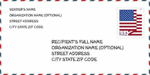
How to write a U.S. envelope?

-
First, you need to fill in the recipient's mailing information in the center of the envelope. The first line is the recipient's name, the second line is the street address with a detailed house number, and the last line is the city, state abbr, and ZIP Code.
Second, write the sender's information on the left top corner of the envelope. If your mail cannot be delivered, it will return to the sender's address.
Finally, don't forget to stick the stamp on the right top corner. Otherwise, the letter will not go into the delivery process.
Here is the envelope example below.
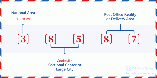
What does each digit of ZIP Code 38587 stand for?
-
The first digit designates a national area, which ranges from zero for the Northeast to nine for the far West.
The 2-3 digits represent a sectional center facility in that region.
The last two digits designate small post offices or postal zones.
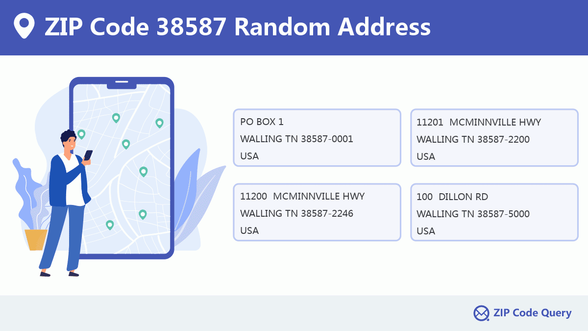
Random Address in ZIP 38587

ZIP Code 38587 has 374 real random addresses, you can clicking the picture below to get random addresses in ZIP Code 38587.
ZIP 38587 Online Map

This is online map of the address WALLING, White County, Tennessee. You may use button to move and zoom in / out. The map information is for reference only.
ZIP 38587 NearBy ZIP Code
The Nearby ZIP Codes are 38579, 38559, 38550, 38583, and 37166, you can find ZIP codes in a 25km radius around ZIP Code 38587 and the approximate distance between the two ZIP codes.
The data has a slight deviation for your reference only.

School in ZIP Code 38587

This is the ZIP Code 38587 - School page list. Its detail School Name, Address, City, State, ZIP Code is as below.
- ·School Name:Central View Elementary School
- ·Address: 14484 Old Kentucky Rd
- ·City: Walling
- ·State: Tennessee
- ·Grades: KG-5
- ·ZIP Code: 38587
Comment


Add new comment